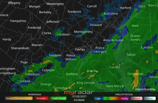
 Radar courtesy MyRadar | © OpenStreetMap contributors | * Flash flood watch expires at 8 a.m. * Today's daily digit A somewhat subjective rating of the day's weather, on a scale of 0 to 10. 6/10: Morning rain and mugginess but a partly sunny afternoon with drier air. There may be some great outdoor hours to enjoy great temperatures for this time of year! Express forecast - Today: A chance of rain but a sunnier afternoon. Highs: 77 to 83.
- Tonight: Clearing. Stray shower? Lows: Upper 50s to low 60s.
- Tomorrow: Midday/afternoon chance of rain. Highs: Upper 70s to low 80s.
- Independence Day: Mostly sunny. Stray shower/storm? Highs: Low to mid-80s.
Forecast in detail After morning rain and the early morning flash flood watch is allowed to expire, we can look forward to weather that's trending nicer. This afternoon into the weekend we have relatively low temperatures and humidity (dew points trying to stay under 60 degrees), and fairly low rain chances. Any July Fourth evening shower/storm should be fairly quick and not too heavy. Today (Friday): As the heaviest, steadiest rain pulls away, our flooding risk abates. A few showers may pester us through midday, especially south and east, but a break is possible in clouds and rain chances through much of the afternoon. Nearer sunset we could see a couple more showers or storms pop, especially in the Interstate 95 corridor and east. Behind the front, humidity drops to comfortable levels (dew points below 60 degrees) as high temperatures aim for the upper 70s to low 80s. Winds blow from the west-northwest near 10 mph, with a couple gusts to 20 mph possible. Confidence: Medium Tonight: Once we are into the evening, skies keep on their clearing trend as drier air (dew points still in the 50s, wow!) continues to filter into the region. We can thank light northwest breezes continuing to blow. Low temperatures bottom out in the upper 50s to low 60s. Confidence: Medium-high Follow us on YouTube, Facebook, Twitter and Instagram for the latest updates. Keep reading for the forecast into next week… Tomorrow (Saturday): Skies are at least partly sunny, but some clouds could accompany midday into afternoon spits of rain. Any showers that develop should not last too long but a few moments of moderate rainfall are possible, as is some thunder, in the afternoon. Humidity remains great for July (dew points in the upper 50s to low 60s) as do the high temperatures in the upper 70s to low 80s. Confidence: Medium Tomorrow night: Predawn low temperatures fall to near 60 degrees, perhaps low 60s inside the Beltway. Skies are partly cloudy and northwest breezes remain very light. Confidence: Medium-high 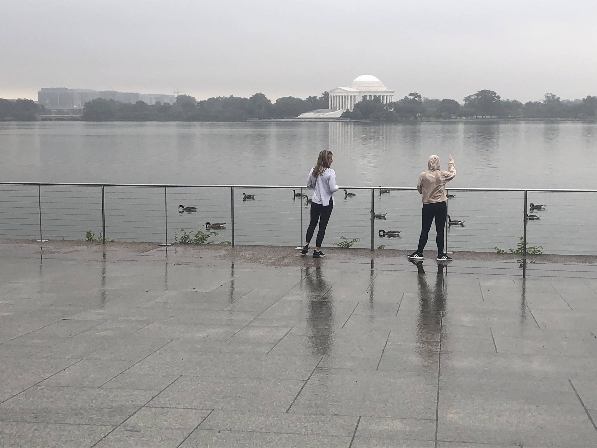 Rain falls on the Tidal Basin and Jefferson Memorial on June 26. (Jeannie In D.C. via CWG.news/Photos) | A look ahead Independence Day (Sunday): Perhaps the best-timed weekend weather gem, we're mostly sunny with high temperatures in the low to mid-80s. Humidity remains under control (dew points around 60 degrees) especially during daytime hours, with the sunshine helping to percolate and stir the atmosphere. Speaking of, light west breezes are possible too. Ahh, it doesn't get better than this around D.C. for the Fourth! Shower chances remain low but stray raindrops are possible, especially late day. Confidence: Medium-high Sunday night: Stray raindrops may be around in the evening, but no widespread or long-lasting showers or storms are expected. We'll keep an eye on this but only tiny — if any — delays for fireworks are currently possible. Evening temperatures in the 70s feel a bit more muggy, but we slowly cool down by sunrise into the mid- to upper 60s with mostly clear skies. Confidence: Medium Low to mid-90s may return as soon as Monday and Tuesday along with noticeable humidity (dew points at least in the mid-60s). When combining Tuesday's air temperature and dew point, our skin can't self-cool as easily, so the apparent "heat index" temperature may feel about 100 degrees in a few locations. Cooling showers and storms may be few and far between. Confidence: Medium-high Holiday weekend beach forecast Showers and a few thunderstorms are likely along the coast Friday, from New Jersey down to North Carolina. A few showers linger into Saturday, especially north. Sunday/Monday should be mainly sunny and dry. High temperatures top out in the upper 70s to low 80s but climb to the mid-80s to near 90 in North Carolina and Virginia. Low temperatures are mainly in the 60s but it's muggy more often than not. Winds are light, for the most part. Water temperatures range from the low 70s along the Jersey Shore to near 80 degrees around Cape Hatteras, with 1-3 foot waves through the weekend. | 

