 Radar courtesy MyRadar | © OpenStreetMap contributors | Today's daily digit A somewhat subjective rating of the day's weather, on a scale of 0 to 10. 2/10: With tornado and flooding threats, it's a rough day. Two points for some salvageable hours in the morning before things go downhill. Express forecast - Today: Numerous showers and storms, some severe, especially in the afternoon. Highs: Near 80.
- Tonight: Evening storms likely, ending around midnight. Lows: 60 to 65.
- Tomorrow: Sunny, delightful. Highs: 75 to 80.
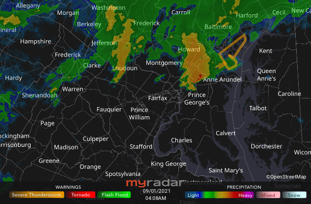
Forecast in detail Today is a serious day of severe weather in the Washington region, with numerous showers and storms that could cause areas of flooding and spawn tornadoes. Have a way to receive storm warnings and seek shelter, if necessary. After today, gorgeous weather — the nicest we've seen in a long time — is with us Thursday into the weekend.  | Storm Threat Level 3 - On High Alert
- Storms likely
- Numerous storms may be severe
| Today (Wednesday): Following possible early-morning showers and storms, we should have a pause for several hours lasting into midday. But during the afternoon, numerous showers and storms are probable, coming through in several rounds. These storms will contain locally heavy downpours that could trigger flooding and strong wind gusts. Some storms will also probably rotate and may produce tornadoes. Highs are near 80. Confidence: Medium 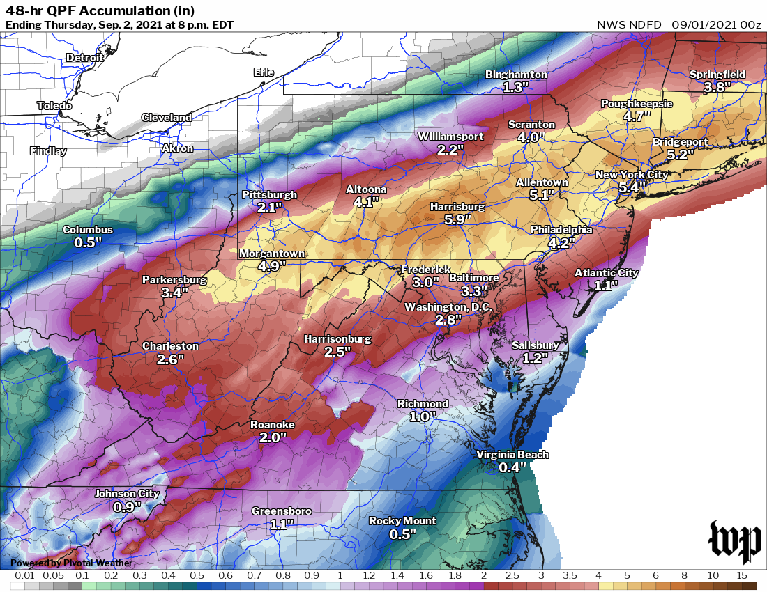 Predicted rainfall through Thursday morning from the National Weather Service. | Tonight: Showers and storms, some severe, persist into the evening, with the continued risk of flooding and perhaps tornadoes. By 11 p.m. or so, showers and storms should be exiting toward the Chesapeake Bay. Partial clearing overnight, with lows 60 to 65. Confidence: Medium 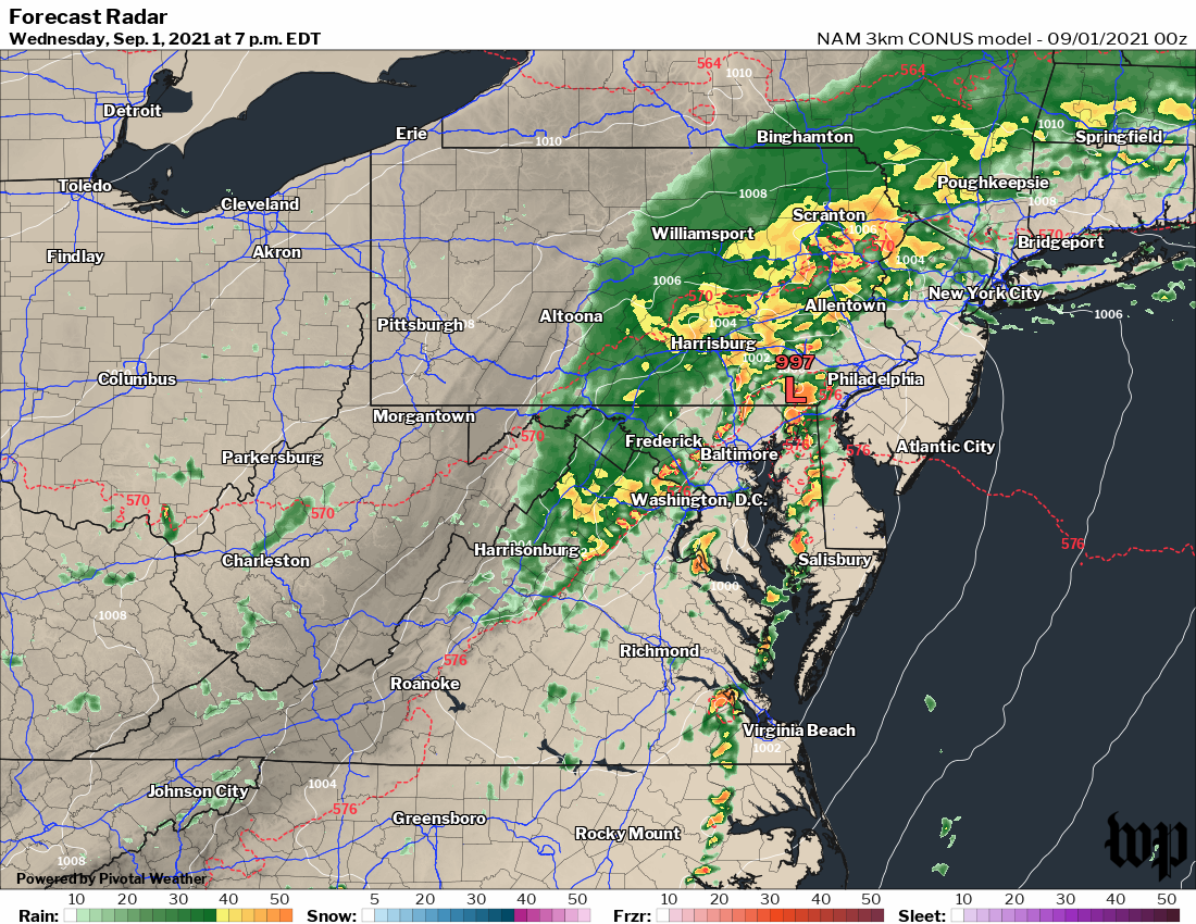 Simulated radar at 7 p.m. Wednesday from the high-resolution NAM model. | Follow us on Facebook, Twitter, and Instagram for the latest weather updates. Keep reading for the forecast through the weekend...  | Nice Day! | Tomorrow (Thursday): Ahhh ... refreshing, much less humid air pours into the region (dew points near 60 early drop into the 50s during the afternoon) and sunshine returns. Skies become mostly sunny, with highs 75 to 80. It is quite breezy, with winds from the north around 15 mph, gusting over 25 mph at times. Confidence: Medium-High Tomorrow night: Mostly clear and comfortably cool as winds slowly ease. Lows range through the 50s. Confidence: High A look ahead Friday through Sunday is generally a nice stretch with plenty of sunshine, although we can't rule out a few more clouds and perhaps some showers Sunday. Highs are mostly in the upper 70s and low 80s. Friday night sees clear skies and lows in the 50s. Lows then warm to the upper 50s to mid-60s (downtown) Saturday and Sunday nights when there may be a few more clouds. Confidence: Medium-High Labor Day looks pretty good, if a bit more summery for summer's unofficial last day. Skies are partly to mostly sunny with highs in the mid-80s. Confidence: Medium | 

